|
Scientific Name | Oxalis camelopardalis T.M.Salter |
Higher Classification | Dicotyledons |
Family | OXALIDACEAE |
National Status |
Status and Criteria | Endangered B1ab(iii,v)+2ab(iii,v) |
Assessment Date | 2012/10/30 |
Assessor(s) | D. Raimondo |
Justification | EOO 27 km², plants at one of the three known locations are declining due to erosion of the banks of the Brandvlei Dam. |
Distribution |
Endemism | South African endemic |
Provincial distribution | Western Cape |
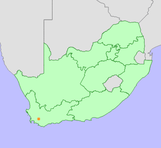
Range | Villiersdorp to Worcester. |
Habitat and Ecology |
Major system | Terrestrial |
Major habitats | Breede Shale Renosterveld, Western Ruens Shale Renosterveld, Elgin Shale Fynbos, Breede Sand Fynbos |
Description | Renosterveld on shales. |
Threats |
| Agriculture is a severe past threat, with over 50% of this taxon's habitat converted for viticulture. Habitat has also been lost to the construction of the Brandvlei dam. Three subpopulations occur right on the edge of the Brandvlei dam, where they are threatened by erosion of their habitat when the dams are filled to capacity and strong winds cause soil banks above the water's edge to collapse. |
Population |
Population trend | Decreasing |
Assessment History |
Taxon assessed |
Status and Criteria |
Citation/Red List version | | Oxalis camelopardalis T.M.Salter | VU D2 | 2012.1 | | Oxalis camelopardalis T.M.Salter | VU D2 | Raimondo et al. (2009) | |
Bibliography |
Raimondo, D., von Staden, L., Foden, W., Victor, J.E., Helme, N.A., Turner, R.C., Kamundi, D.A. and Manyama, P.A. 2009. Red List of South African Plants. Strelitzia 25. South African National Biodiversity Institute, Pretoria.
Salter, T.M. 1944. The genus Oxalis in South Africa: a taxonomic revision. Journal of South African Botany Supplement 1:1-355.
|
Citation |
| Raimondo, D. 2012. Oxalis camelopardalis T.M.Salter. National Assessment: Red List of South African Plants version 2024.1. Accessed on 2025/12/23 |
 Comment on this assessment


